 Now it's growing a branch.
If you look at the work being done to widen Capital Circle Southeast (US 319) between the Woodville Highway and Tram Road, you'll notice a paved asphalt trail to the south of the road. In the description of the project, this is referred to as "a wide meandering sidewalk." It looks like a trail to me.
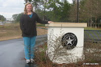
 Such a trail was already added to Capital Circle Southeast between Hill Lane and Tram Road when that portion of the highway was widened. Some of it, especially at the north end, is not very congenial, narrow and hugging the side of US 319. Other portions are wide but out in the open, waiting for recently-planted landscaping to provide some shade in a few decades. At the south end, near the satellite state office complex in Southwood, the trail winds under patriarch live oaks and is set so far back from the highway that you can almost forget the traffic. There are benches along the way, as well as a couple of attractive but nearly useless pillars that remind you that you're on Capital Circle Southeast. Was there ever any danger of forgetting?
 The new stretch of trail, by extending to the Woodville Highway, will effectively connect the existing portion of trail to the Saint Marks Trail. From Hill Lane to the St Marks Trail is about five miles, so when that part of the Capital Circle Southeast trail is done, a ride or walk or run on the St Marks Trail can start up to five miles closer to home for folks on that side of town. None of the trail between Tram Road and Woodville Highway looks like it will be hugging the curb, but it also looks like none of it is going be shaded by a canopy of oak boughs, either. The project site indicates that work on the road is scheduled to be finished in early 2010. Projects run behind schedule, but it's also possible that the trail may be done before the rest of the highway. Much of it looks very close to being done right now.
If you want to dream about the future, widening of Capital Circle from the Woodville Highway to the Crawfordville Highway is planned, just not funded or scheduled. The plans include a "10-foot meandering sidewalk," so figure that we'll get another 1.3-mile branch off of the Saint Marks Trail. This would come close to connecting with the proposed Lake Munson Trail, which would in turn connect with the proposed GF&A trail as well as the existing Lake Henrietta Trail. The GF&A Trail will in turn connect with the (allegedly under construction) Ochlockonee Bay Trail, which no doubt will have links to some other chimerical trails.
Admittedly, you probably won't be following trails from Tallahassee to Panama City next week. But in the near future we'll have a Southwood to Saint Marks connection.
Links:
- Capital Circle SE, Connie Drive to Tram Road
http://www.blueprint2000.org/Project_E1/ - Capital Circle SE, Woodville Highway to Tram Road
http://www.blueprint2000.org/Project_E2/ - Capital Circle SE, Woodville Highway to Crawfordville Highway
http://www.blueprint2000.org/Project_E3/
I would love to know the purpose of the signs that let you know you are on Cap Cir. They seem really out of place. The ew extension looks nice, though. Hot- but nice.
ReplyDeleteMaybe the city of Tallahassee envisions a day when the trail network grows so extensive that we'll need signs to know which trail we're on.
ReplyDeleteMeanwhile, this could add a six-pack to Marklar 2010.