Friday, January 2, 2009

Rocky Mountain Trail

While planning a stay in Unicoi State Park in August 2008 we were looking for some hikes in the area. Several guides mentioned a loop hike that included the Rocky Mountain Trail. However, every source I looked at started from a trailhead on United States Forest Service Road 283. If possible, I wanted to avoid repeating previous adventures we had while driving on the Forest Service Roads in the Chattahoochee National Forest. Fortunately, it's possible to keep your car on paved highways by using the Appalachian Trail as a 0.9 mile approach to the loop.

So our hike started at Unicoi Gap on SR 75. The gap is well-marked on the highway, and there is a sizable parking area on the east side of the road where the hike begins. Near the south end of the parking lot is a boulder on which the Georgia Appalachian Trail Club has placed a bronze Appalachian Trail plaque. Just beyond this the Appalachian trail heads into the woods and up Rocky Mountain on the way to Maine. That's where we started climbing.

The trail does climb rapidly up from the parking area. We had read that for part of the ascent we were going to be hiking along a creek that we'd cross at 0.6 miles, but drought conditions were severe that summer and we didn't see any water at all. (Back in the valley, the Chattahoochee River was too low for tubing.) In fact, of the three water sources along the route that we read about, all three were dry. Hopefully rainfall will pick up again before Atlanta residents have to give up washing their cars and watering their lawns.

One landmark that turned out to be certain was the intersection of the Appalachian Trail with the Rocky Mountain Trail. At a bend in the trail the blue-blazed Rocky Mountain Trail went off to the left, while we kept to the right and stayed on the white-blazed Appalachian Trail. We had read that this intersection was 0.9 miles from Unicoi Gap, so the summit of Rocky Mountain at 1.3 miles from the gap must be another 0.4 miles further on. This is probably true, but it's hard to tell when you're actually at the summit. As you reach the top, the slope of the trail gradually decreases, so it's hard to tell when you're actually at the peak--assuming the trail crosses over the peak. When the trail started going down again, we concluded that we had been at the summit, but we weren't sure when. There are some attractive grassy spots near the trail in this area which seem to have been used for camping.

Shortly after we started down the mountain, the trail crossed some rock outcroppings; the absence of trees at these points gives you unobstructed views to the south. We made our lunch stop here. One unmistakably odd-shaped mountain in the distance was Yonah Mountain, probably the only mountain that I could pick out of a line up. The guidebooks invariably mention that John Muir stopped by Yonah in 1867. The visit has been mentioned so often that I decided it must have been an important episode in Muir's career. So I looked it up in his 1916 book, A Thousand-Mile Walk to the Gulf:

Reached Mount Yonah in the evening. Had a long conversation with an old Methodist slaveholder and mine owner. Was hospitably refreshed with a drink of fine cider.

Well, not as exciting as I thought.

After lunch, we continued on the rapidly descending trail toward Indian Grave Gap, yet another macabre place-name on the Georgia Appalachian Trail. At this gap, 2.7 miles from Unicoi Gap, the Appalachian Trail intersects with the Andrews Cove Trail, the blue blazes of which we saw heading off to the right. The trail also crosses USFS 283, where we turned left, leaving the Appalachian Trail to follow blue blazes up the road. We were now on the Rocky Mountain Trail. We were a bit concerned about missing the spot at 3.3 miles where the trail left USFS 283 to head left into the woods, but we needn't have worried. The Forest Service had put out a highway sign to mark the turn: ROCKY MTN TR NO 114. I'm not sure what all that was supposed to mean, but for us it meant, "Turn here!"

Once in the woods we resumed climbing along the slopes of Rocky Mountain. This time we weren't going to the summit, we were just headed back to the intersection of the Rocky Mountain Trail and the Appalachian Trail, where we'd complete the loop. This was 4.4 miles into our hike, just past a small campsite. We turned right onto the Appalachian Trail and started to make our way back down the mountain to Unicoi Gap. It's as steep going down as it is going up, and though the ascent works your hearts and lungs, you certainly feel the descent in your knees and thighs. Even so, it was faster work in this direction and we were soon back at our car in Unicoi Gap.

Here's a summary of the route:

MILEAGE

NOTES

0.0

Unicoi Gap (2949 feet). Start from the parking lot on the east side of SR 75. Find the white-blazed Appalachian Trail near the boulder adorned with a bronze Appalachian Trail plaque, and begin climbing.

0.9

Intersection with the blue-blazed Rocky Mountain Trail. Continue to the right, following the white blazes of the Appalachian Trail.

1.3

The summit of Rocky Mountain (4017 feet).

1.5

Rock outcrops with some great views to the south, including a view of Yonah Mountain.

2.7

Indian Grave Gap (3113 feet). Intersection with the blue-blazed Andrews Cove Trail and with United States Forest Service Road 283. Turn left onto USFS 283.

3.3

Turn left, following the blue blazes of the Rocky Mountain Trail off of USFS 283 and into the trees.

4.4

Back at the intersection of the Rocky Mountain Trail and the Appalachian Trail. Head to right retracing your steps along the Appalachian Trail, starting the descent back to Unicoi Gap.

5.3

Unicoi Gap (2949 feet).


I found these books useful in planning the hike:

Grove, Doris (1998). Exploring the Appalachian Trail: Georgia North Carolina Tennessee.

Homan, Tim (2001). The Hiking Trails of North Georgia.

Jack Coriell, et al. (ed). Appalachian Trail Guide to North Carolina-Georgia.

Thursday, January 1, 2009

Lake Henrietta Trail

[ Originally posted to the Gulf Winds Track Club Yahoo! Group, and then published at http://www.gulfwinds.org/Trails/Lake%20Henrietta%20Trailhead%20(8-02-08).htm ]

The trailhead is located on Springhill Road about 0.7 miles south of the intersection of West Orange Avenue and Springhill Road.

The trail is a wide, blacktopped bike trail that makes a circuit of just over two kilometers (I measured it at 6700 feet) around Lake Henrietta. A pair of sturdy bridges near the trailhead are currently closed, guarded by quietly menacing signs reading "Keep Off Bridge." There is no bridge over Lake Henrietta's southern outlet; I don't know if one is planned or if trail users will have to ford the outlet at times of high water. Beyond a gate near this outlet is a dirt trail along Munson Slough, which flows south to Lake Munson by way of Capital Circle.

The lake is appreciated by birds, turtles, and at least one alligator. The trail appears to only be accessible from the trailhead along Springhill Road, which has a very small parking area. Trail users will also have to bring their own shade--there are no trees close to the trail.

In the Future, the Lake Henrietta Trail may connect with the St Marks Trail through the Capital Cascades Greenway trail system. This will also connect with the GFA trail, and you will be able to connect with passenger service to the Moon through Tallahassee Municipal Airport.

Trailhead location on Google maps:
http://maps.google.com/maps?f=q&hl=en&geocode=&q=30.403569,-84.307993&sll=30.403532,-84.308047&sspn=0.001113,0.001727&ie=UTF8&t=h&g=30.403569,-84.307993&ll=30.404157,-84.307988&spn=0.008902,0.013819&z=16

Tuesday, December 30, 2008

Big Oak Trail (Lazy Man's Version)

The Big Oak Trail is a hike largely in Suwannee River State Park that includes abandoned highway bridges, the ghost town of Ellaville, the Suwannee River, the Withlacoochee River, springs, sinks, and (of course) the Big Oak. It's a bit long, though. The Florida Trail Association lists it at just over eleven miles while Sandra Friend (50 Hikes in North Florida) gives the length as twelve-and-a-half miles. I didn't want to go quite that far, especially because around four miles of that total is trail that you double back on to return to your starting point. However, the heart of the hike is a loop of just over four miles on the peninsula between the Withlacoochee River and the Suwannee River. You can't walk just the loop, but you can park close enough to cut the total distance to just over five miles.

Access is along a gas pipeline on the south side of CR 141 just east of the bridge over the Withlacoochee River (i.e., here). We ended up parking on the shoulder of the highway. From the road, you follow the orange-blazed Florida Trail along a driveway to a gate. There is passage alongside the gate for hikers. This takes you on to a gas pipeline right-of-way which will take you in a southerly direction to the boundary of Suwannee River State Park. The gas line itself is desolate and depressingly straight, so concentrate on the scenery to each side--meadows and rich hardwood forest.

Crossing the park boundary, you're now on the loop. You can continue straight along the gas pipeline and do the loop clockwise, but we chose to turn right and do the loop counter-clockwise. The orange blazes lead you along the park's fenceline before making a sharp left onto an old road. Hikers follow the old road to the rim of a deep sinkhole, at which point the orange blazes lead you toward the Withlacoochee River and away from the road. Don't worry, you'll see the road again. It runs nearly to the southern tip of the peninsula, and the trail follows it on several stretches on the way south.

Past the sinkhole the trail takes you along the Withlacoochee River in the downstream direction. Depending on the water level in the river, you may hear the water rushing over some limerock shoals. After this first meeting, though, the Withlacoochee flows quietly between its steep limestone banks. Turtles sun themselves near the shores and hawks glide overhead. Not many other hikers shared the trail with us, but boats and kayaks went by on the river below, and families camped and fished on the opposite side of the Withlacoochee.

Very close to the south end of the loop you can look across the river and see the ruins of an old wall that was built to impound the waters of Suwannacoochee Spring, part of Ellaville, a vanished lumbermill town. Straight ahead you'll soon spot the picnic table and fire ring that mark the primitive campground at the southern tip of the peninsula. This is a good spot to stop, rest, and look at the confluence of the Suwannee River and the Withlacoochee River. Looking downstream, you can see three bridges that still exist in this area--the CSX rail bridge, the old US 90 bridge, and the current US 90 bridge. You can also look across the Suwannee at the more active portion of Suwannee River State Park (actually, you'll probably have already heard the noise from all that activity).

From the camping area, the trail heads back north (upstream) along the west bank of the Suwannee River. After about half a mile of following the Suwannee, the trail crosses the barren avenue of the gas pipeline. Huge signs warn boaters not to "anchor or dredge" where the pipeline crosses the river. Once you've walked across the pipeline, start keeping an eye out for the "Big Oak" for which the trail is named. Less than a quarter mile past the pipeline, the "Big Oak" will be on the left side of the trail. It's an old live oak that is significantly larger than the other big live oaks in the area.

Beyond the "Big Oak," the trail and the Suwannee River angle away from each other. There are no more river views, but plenty of woods, occasional sinkholes, and the possibility of wildlife sightings. Before completing the loop, you'll come to an intersection and the only sign (other than mileposts) on the loop. The orange-blazed Florida Trail goes right toward Key West, but you'll want to take the blue-blazed trail to the left that goes back toward your car. From the sign you follow the blue blazes back to the gas pipeline where you turn right. The pipeline takes you to the park boundary, where you complete the loop and rejoin the orange-blazed Florida Trail. Retrace your steps north along the pipeline back to CR 141.

The loop isn't absolutely flat, but it comes close. There were quite a few trees and branches down across the trail the day we hiked the loop (28 December 2008), but one work crew could change that.

More photos of the trail
http://www.facebook.com/album.php?aid=2557776&id=5215641&l=3082af97f0

Here are some links I used in planning our walk in the woods.

Grab and Go: Big Oak Trail
http://www.floridatrail.org/Hiking/Grab-and-Go/GGbigoaktrail.html
From the Florida Trail Association. You'll want the trail map.

Florida Hikes! Big Oak Trail
http://www.floridahikes.com/north/big-oak-trail.html
Sandra Friend's excellent take on the trail.


Friday, December 26, 2008

26 December 2008 Tallahassee 100-Mile Race Calendar


Here are some upcoming races within 100 miles of Tallahassee, Florida (this area is shown in the map above). If a race isn't listed, I probably don't know about it and you should post a comment.

27 DEC 2008 Last Gasp 5K Trail Run
5 km on dirt running trails
9:00am ct
Westgate Park
801 Recreation Rd
Dothan, AL 36303
Event web site
Listing on active.com
1 JAN 2009 New Year's Day 5K and 1 mile 9:30am ET 5K / 10:30 am ET one mile
S. L. Mason School
Baytree Road and Azalea Drive
Valdosta, GA
Call Get Active Running & more, 229-219-0010
3 JAN 2009 5th Annual Bainbridge Kiwanis River Run
10 km and 5 km road races
9:00 am ET
Earle May Boat Basin
Boat Basin Circle
Bainbridge, GA 39819
Online registration at active.com
Entry form and flyer
USATF certified 10K course GA05001WC
10 JAN 2009 Bowlegs 5K Run For Scholarship 9:00am ET
FAMU / FSU School of Engineering Building
2525 Pottsdamer St
Tallahassee, FL 32310
Registration form and flyer
10 JAN 2009 Berrien County Recreation Department 4th Annual 5K Fun Run & One-Mile Run/Walk 8:30am ET 5 km / 9:30am ET one mile
Berrien Recreation Center
1015 Exum Rd.
Nashville, Ga. 31639
Registration form and flyer
17 JAN 2009 Gulf Winds Track Club 30K / 15K 7:30am ET
The Retreat at Bradley's Pond
9002 Bradley Road
Tallahassee, FL 32309
Online registration at active.com
Registration form and flyer
USATF certified courses FL06013DL (30K) and FL06014DL (15 K)
24 JAN 2009 4th Annual Special Olympics Leon County 5K 9:00am ET
Mike Long Track
Florida State University
Chieftan Way at Spirit Way
Tallahassee, FL 32304
Event web site
Online registration at active.com
USATF certified course FL06015DL.
Registration form and flyer
24 JAN 2009 YMCA Run Around The Town 7:30am ET
Lee County Parks & Rec Gym
116 Starksville Street
Leesburg, GA 31763
Online registration at active.com
Registration form and flyer
31 JAN 2009 Nun Run 5K Road Race & One-Mile Fun Run 8:15am ET
St. Teresa's School
417 Edgewood Lane
Albany, GA 31707
Event web site
Online registration at active.com
Registration form and flyer
31 JAN 2009 27th Annual Hog Wild 5-Mile Run & One-Mile Pig Trail Trot 2:00pm CT
Westgate Park
801 Recreation Rd
Dothan, AL 36303
Event web site
USATF course certification not current (AL84001TC)
1 FEB 2009 Tallahassee Marathon and Half-Marathon 7:30 am ET
Mike Long Track
Florida State University
Chieftan Way at Spirit Way
Tallahassee, FL 32306
Event web site
Online registration at active.com
Registration form and flyer
USATF certified course FL06020DL (Marathon), FL06021DL (half-Marathon)
7 FEB 2009 14th Annual Run for the Cookies
5 km run and one-mile fun run
8:30 am ET (one mile) / 9:00 am ET (5 km)
Tallahassee Community College Lifetime Sports Complex
444 Appleyard Drive
Tallahassee, FL 32304
Online registration on active.com
Registration form and flyer
USATF certified course FL08011EBM
14 FEB 2009 "Home is Where the Heart Is" Valentine's 5K 9:00am ET
Tully Gymnasium, Florida State University
Chieftan Way at Spirit Way
Tallahassee, FL 32306
Registration form and flyer
21 FEB 2009 Flash 12 km / 6 km 8:30am ET
J Lewis Hall Park
7575 Old Woodville Road
Woodville, FL 32305
Registration form and flyer
21 FEB 2009 St. Andrew's Mardi Gras 5 km Run/Walk 8:00 am CT
Oaks along the Bay Park
10th Street and Beck Ave
Panama City, FL 32402
Online registration at active.com
28 FEB 2009 Race Judicata 5K 8:00am ET
Florida State University College of Law
425 W. Jefferson Street
Tallahassee, FL 32301
USATF certified course FL02044DL
Lauren Strickland, laurenstrickland@gmail.com
28 FEB 2009 7th Annual Holy Nativity Episcopal School 5 km run and one-mile fun run 8:00am CT
Holy Nativity Episcopal School upper campus
205 Hamilton Avenue
Panama City, FL 32401
850-747-0060
7 MAR 2009 Thomasville Road Baptist Church 5K, 10K & 1 Mile Fun Run 8:00am ET one mile / 8:30am ET 5 km and 10 km
Thomasville Road Baptist Church
3131 Thomasville Road
Tallahassee, FL 32309
Event web site
7 MAR 2009 Snickers® Marathon® Energy Bar Marathon, Half Marathon, and one-mile fun run 7:00am ET
Veteran's Park
Front Street
Albany, GA
Event web site
Online registration at active.com
Regisration form and flyer
USATF certified course GA07003WC (Marathon), GA07002WC (half-Marathon)
14 MAR 2009 Azalea 5K & One-Mile Fun Run/Walk 8:00am ET fun run / 8:30am ET 5K
VSU Recreation Center
1500 Sustella Ave
Valdosta, GA 31698
Event web site
Registration form and flyer
28 MAR 2009 34th Annual Springtime 10K, Publix 5K & Fun Station 1-Miler 8:00am ET
Leon County Courthouse
301 S Monroe St
Tallahassee, FL 32301
Event web site
Online registration at active.com
USATF certified course FL96048DL (10 km)
11 APR 2009 35th Annual Palace Saloon 5 km 8:00am ET
James Messer Fields Park
Jackson Bluff Road and Dupree Street
Tallahassee, FL 32304
Online registration at active.com
USATF certified course FL99027DL

Tuesday, December 23, 2008

Gopher, Frog, and Alligator Trail Construction

For years I've been hearing about the GFA Rail Trail, to be built on the bed of the old Georgia, Florida, and Alabama (aka Gopher, Frog, and Alligator) Railroad between Tallahassee and Carrabelle. Never mind that some of the railbed is in people's yards or beneath city streets or under a runway of the Tallahassee Municipal Airport. Don't worry about the hostility of hunting interests to a trail in the Apalachicola National Forest. Forget about the problem of bridging the Ochlockonee River. One Day the trail would be built, all 53 miles of it. Run a marathon on the St. Marks Trail? You would be able to run two marathons back-to-back, on the GFA Trail and never re-trace a single step. And it would indeed happen One Day. After all, the Florida Department of Transportation had added a ten-foot bike lane to the bridge over Fisher Creek on Springhill Road. A mile to the north,the United States Forestry Service had added the legend "GFA Trailhead" to the sign for the Trout Pond Recreation Area (and only those of little faith would point out that the USFS had also added "CLOSED" to the same sign).

This past week I heard that construction on the trail had actually been spotted along Springhill Road. I wanted to see it. I have faith and hope in this project, but I still wanted to see it. So Saturday (2008 July 26) I went to take a look.

You have to drive a long way south of town on Springhill Road before you spot the first construction a bit south of the Trout Pond Recreation Area. The farthest south the current stage of the project goes is Helen Guard Station Road, just north of the Wakulla County line. North of Helen, the railbed has been graded and a layer of crushed lime laid down. Or maybe sand mixed with gravel. Anyway, something to serve as a foundation for the first layer of pavement.

At Fisher Creek, the trail veers east of the old railbed to cross the creek on the bicycle lane that has been added to the Springhill Road bridge. After the bridge the trail jogs back to the west to rejoin the railbed. The railbed is a bit higher than Springhill Road here,so you get something you seldom see on a rail-trail: a hill.

A bit north of Fisher Creek, the trail suddenly makes a hard turn to the east, leaves the old railbed, and crosses Springhill Road. After crossing Springhill Road, the trail turns gently to the north, apparently towards Trout Pond Recreation Area, which is on the opposite side of Springhill Road from the old railbed. On this side of Springhill Road, a layer of blacktop has already been added to the trail.

That's how things stood the day of my visit. This part of the project should be done soon, but you won't be able to run a marathon on it--it's only around two miles long. You could run an out-and-back 5K on the trail, but I wouldn't advise it because of the Springhill Road crossing. It could be very important as a segment of the longer trail, but I don't know when that's going to happen.

Bill Crooks once told me that there was a running track inside of the Federal Correctional Institute off of Capital Circle. That was interesting information, but not immediately useful. In fact, I'm inclined to hope that it never becomes useful. I have to put this news about the GFA Trail in a similar category of interesting but not immediately useful. The difference is that I remain hopeful that this GFA information will be useful one day.

[ Since I wrote the above, paving of this first portion of the GF&A Trail has been completed. We're still over 50 miles short of a paved rail-trail from Tallahassee to Carrabelle, but it's a start. ]

Original appearance:
http://www.gulfwinds.org/Trails/GFA%20Trail%20(07-30-8).htm

Map at USATF's America's Running Routes:
http://www.usatf.org/routes/view.asp?rID=234168

More photos of the trail under construction:
http://www.facebook.com/album.php?aid=2477240&id=5215641&l=39a2010ec3

Another visit to the GF&A trail:
http://troubleafoot.blogspot.com/2009/01/another-visit-to-gf-trail-tallahassee.html

Monday, December 22, 2008

Ellaville Loop, Twin Rivers State Forest

One of my favorite walks in north Florida is the Ellaville loop in the Twin Rivers State Forest. It's not an obscure trail--it's a listed trail in the Florida Division of Forestry's Trailwalker program, and a good bit of the loop is actually part of the Florida Trail. But I've never been there when I had to share the five-mile loop with more than a couple of other groups of hikers, the scenery never disappoints, and there are no strenuous climbs or descents.

The trail head is at the end of a dirt road south of US 90 just west of the Suwannee River. Parking is under some serious-looking power lines. Most often I've done the loop clockwise; to do this you'll toward the river on a small road. At the river, you'll pick up the orange blazes of the Florida Trail. Follow these downstream. You'll soon pass under the serious-looking power lines for the second time; you'll see different sets of these eight times during the loop. You should also be able to see the source of the power lines on the far bank of the Suwanee--Progress Energy's Suwannee River Power Plant. Depending on the water level, you should also soon be able to see and hear some "rapids" as the Suwannee passes over some limerock shoals. At times the river level has been low enough that the Suwannee is nothing but rapids flowing over shoals. I suspect that at other times the river is deep enough that the shoals aren't evident, but the trail might be underwater then. As you head southerly on the trail there are nothing but great views of the Suwannee.

Shortly after you pass under power lines for the fifth time, you'll come to Interstate 10 and the southernmost portion of the loop. The intersection is clearly marked, but make sure that you follow the blue blazes of the trailwalker trail to the north rather than continuing east along the orange-blazed Florida Trail. Most of the northbound trek is along dirt roads through wooded areas. You don't get the views of the river that you do on the journey south, but I have never failed to see groups of feral pigs on this part of the loop. There are also several places where you can see the remains of old farming enclosures back in the trees--shabby wire-and-sheet-metal structures of indeterminate use. Count three sets of power lines on your walk north; the fourth will be the trail head and the end of the loop.

Thursday, December 18, 2008

18 December 2008 Tallahassee 100-Mile Race Calendar

Here are some upcoming races within 100 miles of Tallahassee, Florida (this area is shown in the map above). If a race isn't listed, I probably don't know about it and you should post a comment.

20 DEC 2008 Salvation Army Run For Kindness 5K Trail Run
5 km on dirt running trails
9:00am ct
Westgate Park
801 Recreation Rd
Dothan, AL 36303
John Dove 334-793-7117
27 DEC 2008 Last Gasp 5K Trail Run
5 km on dirt running trails
9:00am ct
Westgate Park
801 Recreation Rd
Dothan, AL 36303
Event web site
Listing on active.com
1 JAN 2009 New Year's Day 5K and 1 mile 9:30am ET 5K / 10:30 am ET one mile
S. L. Mason School
Baytree Road and Azalea Drive
Valdosta, GA
Call Get Active Running & more, 229-219-0010
3 JAN 2009 5th Annual Bainbridge Kiwanis River Run
10 km and 5 km road races
9:00 am ET
Earle May Boat Basin
Boat Basin Circle
Bainbridge, GA 39819
Online registration at active.com
Entry form and flyer
USATF certified 10K course GA05001WC
10 JAN 2009 Bowlegs 5K Run For Scholarship 9:00am ET
FAMU / FSU School of Engineering Building
2525 Pottsdamer St
Tallahassee, FL 32310
Registration form and flyer
10 JAN 2009 Berrien County Recreation Department 4th Annual 5K Fun Run & One-Mile Run/Walk 8:30am ET 5 km / 9:30am ET one mile
Berrien Recreation Center
1015 Exum Rd.
Nashville, Ga. 31639
Registration form and flyer
17 JAN 2009 Gulf Winds Track Club 30K / 15K 7:30am ET
The Retreat at Bradley's Pond
9002 Bradley Road
Tallahassee, FL 32309
Online registration at active.com
Registration form and flyer
USATF certified courses FL06013DL (30K) and FL06014DL (15 K)
24 JAN 2009 4th Annual Special Olympics Leon County 5K 9:00am ET
Mike Long Track
Florida State University
Chieftan Way at Spirit Way
Tallahassee, FL 32304
Event web site
Online registration at active.com
USATF certified course FL06015DL.
Registration form and flyer
24 JAN 2009 YMCA Run Around The Town 7:30am ET
Lee County Parks & Rec Gym
116 Starksville Street
Leesburg, GA 31763
Online registration at active.com
Registration form and flyer
31 JAN 2009 Nun Run 5K Road Race & One-Mile Fun Run 8:15am ET
St. Teresa's School
417 Edgewood Lane
Albany, GA 31707
Event web site
Online registration at active.com
Registration form and flyer
31 JAN 2009 27th Annual Hog Wild 5-Mile Run & One-Mile Pig Trail Trot 2:00pm CT
Westgate Park
801 Recreation Rd
Dothan, AL 36303
Event web site
USATF course certification not current (AL84001TC)
1 FEB 2009 Tallahassee Marathon and Half-Marathon 7:30 am ET
Mike Long Track
Florida State University
Chieftan Way at Spirit Way
Tallahassee, FL 32306
Event web site
Online registration at active.com
Registration form and flyer
USATF certified course FL06020DL (Marathon), FL06021DL (half-Marathon)
7 FEB 2009 14th Annual Run for the Cookies
5 km run and one-mile fun run
8:30 am ET (one mile) / 9:00 am ET (5 km)
Tallahassee Community College Lifetime Sports Complex
444 Appleyard Drive
Tallahassee, FL 32304
Online registration on active.com
Registration form and flyer
USATF certified course FL08011EBM
14 FEB 2009 "Home is Where the Heart Is" Valentine's 5K 9:00am ET
Tully Gymnasium, Florida State University
Chieftan Way at Spirit Way
Tallahassee, FL 32306
Registration form and flyer
21 FEB 2009 Flash 12 km / 6 km 8:30am ET
J Lewis Hall Park
7575 Old Woodville Road
Woodville, FL 32305
Registration form and flyer
7 MAR 2009 Snickers® Marathon® Engergy Bar Marathon, Half Marathon, and one-mile fun run 7:00am ET
Veteran's Park
Front Street
Albany, GA
Event web site
Online registration at active.com
Regisration form and flyer
USATF certified course GA07003WC (Marathon), GA07002WC (half-Marathon)
14 MAR 2009 Azalea 5K & One-Mile Fun Run/Walk 8:00am ET fun run / 8:30am ET 5K
VSU Recreation Center
1500 Sustella Ave
Valdosta, GA 31698
Event web site
Registration form and flyer

Wednesday, December 10, 2008

10 December 2008 Tallahassee 100-Mile Race Calendar

Here are some upcoming races within 100 miles of Tallahassee, Florida (this area is shown in the map above). If a race isn't listed, I probably don't know about it and you should post a comment.
13 DEC 2008Tallahassee Ultra Distance Classic 50 km / 50 miles on a loop course7:00am et Wakulla Springs State Park Wakulla Springs, FLEvent web site Registration on active.com Registration form and flyer
13 DEC 2008Jingle Bell Run / Walk
5K run and one-mile fun run
9:00am ct 5 km / 9:30 am ct one-mile HealthSouth Rehab Hospital 1736 East Main Street Dothan, ALEvent web site (including online registration). Listing on active.com
13 DEC 2008Morale, Welfare, and Recreation Holiday 10K 10 km run and one-mile youth run9:00am ct US Navy MWR Marina 101 Vernon Ave Panama City Bch, FL 32407Listing on active.com
13 DEC 2008Jingle Bell Run and Fun Walk 5 km run and 0.8-mile fun walk5:00pm et 5K / 6:00pm et 0.8 mile Guardian ad Litem Building on Lake DeSoto 406 NE Lake DeSoto Cir Lake City, FL 32055Event web site Online registration at active.com Registration form and flyer
20 DEC 2008Salvation Army Run For Kindness 5K Trail Run
5 km on dirt running trails
9:00am ct
Westgate Park
801 Recreation Rd
Dothan, AL 36303
John Dove 334-793-7117
27 DEC 2008Last Gasp 5K Trail Run
5 km on dirt running trails
9:00am ct
Westgate Park
801 Recreation Rd
Dothan, AL 36303
Event web site
Listing on active.com
3 JAN 20095th Annual Bainbridge Kiwanis River Run
10 km and 5 km road races
9:00 am ET
Earle May Boat Basin
Boat Basin Circle
Bainbridge, GA 39819
Online registration at active.com
USATF certified 10K course GA05001WC
10 JAN 2009Bowlegs 5K Run For Scholarship9:00am ET
FAMU / FSU School of Engineering Building
2525 Pottsdamer St
Tallahassee, FL 32310
Registration form and flyer
10 JAN 2009Berrien County Recreation Department 4th Annual 5K Fun Run & One-Mile Run/Walk8:30am ET 5 km / 9:30am ET one mile
Berrien Recreation Center
1015 Exum Rd.
Nashville, Ga. 31639
Registration form and flyer
17 JAN 2009Gulf Winds Track Club 30K / 15K7:30am ET
The Retreat at Bradley's Pond
9002 Bradley Road
Tallahassee, FL 32309
Online registration at active.com
Registration form and flyer
USATF certified courses FL06013DL (30K) and FL06014DL (15 K)
17 JAN 2009Wine Dog Run for the Paws Half Marathon & 5k8:00am CT
Tyndall Air Force Base
Panama City, FL 32405
Event web site
Registration on active.com
Registration form and flyer
24 JAN 20094th Annual Special Olympics Leon County 5K9:00am ET
Mike Long Track
Florida State University
Chieftan Way at Spirit Way
Tallahassee, FL 32304
Event web site
Online registration at active.com
USATF certified course FL06015DL.
Registration form and flyer
24 JAN 2009YMCA Run Around The Town7:30am ET
Lee County Parks & Rec Gym
116 Starksville Street
Leesburg, GA 31763
Online registration at active.com
Registration form and flyer
31 JAN 2009Nun Run 5K Road Race & One-Mile Fun Run8:15am ET
St. Teresa's School
417 Edgewood Lane
Albany, GA 31707
Event web site
Online registration at active.com
Registration form and flyer
31 JAN 200927th Annual Hog Wild 5-Mile Run & One-Mile Pig Trail Trot2:00pm CT
Westgate Park
801 Recreation Rd
Dothan, AL 36303
Event web site
USATF course certification not current (AL84001TC)
14 MAR 2009Azalea 5K & One-Mile Fun Run/Walk8:00am ET fun run / 8:30am ET 5K
VSU Recreation Center
1500 Sustella Ave
Valdosta, GA 31698
Event web site
Registration form and flyer

Monday, December 8, 2008

Four Freedoms Trail, Madison, Florida

It's not listed in the Florida's Office of Greenways and Trails guide, nor is it listed by the Rails-to-Trails Conservancy but Madison has a very nice rail-trail, the Four Freedoms Trail.

The south end of the trail is in Hanson (which is little more than a sign along the highway), about seven miles north of Madison along the Colin Kelly Highway (SR-145). The trail parking area are on the west side of the highway, and is not particularly inviting. There isn't a huge sign marking the trailhead, and the surrounding weeds don't provide much shade. A large, black lump on the ground shows where the trail paving crew dumped their excess asphalt at the end of the job.

Just a few hundred yards outside of the parking area, though, the trees close in and the trail is protected by a leafy canopy. The way is mostly wooded for about two miles until you approach the village of Pinetta. At this point I can only guess that there was some trouble obtaining the right-of-way to the old rail grade, because at this point the trail ceases to follow the old rail route. Instead, the trail follows a paved bike lane along Persimmon Drive. In the center of Pinetta the bike lane vanishes for a block or two and you're on the streets. This isn't much of a problem, though, because this part of Pinetta hasn't seen much traffic since before the railroad left. If you want to visit the village store or barbecue restaurant, those are a block east of the trail near the Colin Kelly Highway.

After another brief spell on bike lanes, the trail resumes north of Pinetta on the west side of Persimmon Drive. Around the 3-1/2 mile point, the trail crosses to the east side of the road, passes a good-sized parking area with picnic tables, and then plunges into the woods. For the next two miles you'll see little but trees to either side of you. Additionally, the trail acquires a noticeable downward grade--you're headed downhill to the Withlacoochee River and the state line.

Five-and-a-half miles from the Hanson trailhead, the Four Freedoms Trail ends at the Withlacoochee River. There's a picnic table under a shelter at the south end of the trail and an observation deck overlooking the river. The opposite bank of the river is Lowndes County, Georgia. Part of the old railroad trestle that carried the trains across the river still stands on the Florida side of the Withlacoochee. This is a pleasant spot to stop and eat a snack, watch birds, or fish. Or you could stare at the water, and imagine what an amazing ride you could have if the trail continued across the river and up the old rail grade into Valdosta.

I've bicycled the Four Freedoms Trail twice; there wasn't much traffic on it either time. In fact, I don't remember if I saw any other bicycle riders, altho' there were several folks walking on the trail. At only five-and-a-half miles (an eleven-mile round trip), it's probably not worth a long drive to visit, but if you're near the area you should definitely check it out. From the center of Madison, Florida head east on Base Street (US 90), and then turn left (north) onto Duval Street. Duval Street ends at Livingston Street, where you should turn right (follow the signs pointing to Valdosta). Livingston Street becomes the Colin Kelly Highway (SR-145).

Links:

Thursday, December 4, 2008

4 December 2008 Tallahassee 100-Mile Race Calendar

This is my first attempt at a comprehensive road-racing calendar for the Tallahassee area (i.e., the area within 100 miles of Tallahassee). This version only covers the 6 December 2008 and 13 December 2008 weekends. I'm hoping that later versions will show the race schedule farther in advance. I'm also hoping that I don't get fed up and forget about doing any later versions. So here goes.

Here are some upcoming races within 100 miles of Tallahassee, Florida (this area is shown in the map above). If a race isn't listed, I probably don't know about it and you should drop me a line at hwills@gmail.com or leave a comment. Feel free to do the same if you have more complete information about any of the races.

6 DEC 2008Gulf Winds Track Club Ten-Mile Challenge
10-mile and 5-mile road races
8:00am et
Killearn Lakes Elementary School
8037 Deerlake Drive East
Tallahassee, FL 32312
Online registration at active.com
USATF certified courses FL07049EBM (10 mile) and FL07048EBM (5 mile)
Registration form and flyer
6 DEC 2008Jingle Bell Jog
10 km and 5 km road races and one-mile fun run
8:00am et (10 km) / 9:00am et (5 km)
Tift Park
Corner of 5th and Monroe
Albany, GA 31701
Event web site
Registration form and flyer
Online registration at active.com
USATF certified courses GA05018WC (10 km) and GA05017WC (5 km)

6 DEC 2008Holmes County Health Department Reindeer Run
5 km run/walk
8:00am CT
Bonifay Piggly Wiggly
911 N Waukesha St
Bonifay, FL 32425
Traci Corbin at 547-8500 x249
6 DEC 2008Reindeer 5K Run & Fitness Walk
5 km road race
8:30am et
The Port Inn
501 Monument Ave
Port St. Joe, FL 32456
Event web site
Listing on active.com
6 DEC 20085th Annual Jingle Bell Classic
15 km, 5 km, and one-mile
8:30 am et (5 km and 15 km) / 10:30 am (one mile)
Converse Dalton Ferrell House
305 N. Patterson Street
Valdosta, GA
Event web site (online registration)
Registration form and flyer
6 DEC 2008Kiwanis Hometown Holiday Celebration Fun Run
5 km and one-mile fun run
2:00pm et
8th Street Middle School
8th and Forrest Streets
Tifton, GA
Event web site
Registration form and flyer
6 DEC 2008Tallahassee Jingle Bell Run
3 km road run
6:15pm et
Bloxham Park
Park Avenue at Monroe Street
Tallahassee, Florida 32301
Event web site
Registration form and flyer
13 DEC 2008Tallahassee Ultra Distance Classic
50 km / 50 miles on a loop course
7:00am et
Wakulla Springs State Park
Wakulla Springs, FL
Event web site
Registration on active.com
Registration form and flyer
USATF certified course
13 DEC 2008Jingle Bell Run / Walk
5K run and one-mile fun run
9:00am ct 5 km / 9:30 am ct one-mile
HealthSouth Rehab Hospital
1736 East Main Street
Dothan, AL
Event web site (including online registration).
Listing on active.com
13 DEC 2008Morale, Welfare, and Recreation Holiday 10K
10 km run and one-mile youth run
9:00am ct
US Navy MWR Marina
101 Vernon Ave
Panama City Bch, FL 32407
Listing on active.com
13 DEC 2008Jingle Bell Run and Fun Walk
5 km run and 0.8-mile fun walk
5:00pm et 5K / 6:00pm et 0.8 mile
Guardian ad Litem Building on Lake DeSoto
406 NE Lake DeSoto Cir
Lake City, FL 32055
Event web site
Online registration at active.com
Registration form and flyer

Saturday, November 1, 2008

Site Map

Tallahassee-Area Trails

Other Trails

Books

Tallahassee-Vicinity Road-Race Calendars

Athletics

Other Stuff

Monday, February 18, 2008

2008 Flash 12K

[ Rescued from one of my old myspace blogs. ]

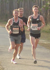
Tripp Southerland ran away from the competition in the late stages of the race to win the 20th Annual Flash 12K, held the morning of Saturday, 16 February 2008 south of Tallahassee. Southerland's time in the 7-1/2 mile event was 43:09.92. Stephanie Liles won the women's title, running 50:56.01. Among the masters, the fastest man was Tim Unger at 44:56.79 and the top woman was Kirsten Baggett who finished at 56:30.39.

By the end of two miles, three runners--Southerland, Vince Molosky, and John Robida--had run away from the rest of the field. The three hung together until the last mile, when Southerland moved into the lead for good, eventually finishing almost 17 second ahead of runner-up John Robida's 43:26.49. Molosky hung on to finish third in 43:54.72.

Remember that the 34th Annual Palace Saloon 5K is coming up on 12 April 2008!